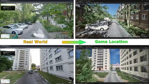
We rebuild places from the grain of their ground. We recreate real-world locations, preserving their terrain and architecture., Heightmaps drive our 3D geodesign to prototype relief with precision., Satellite imagery and panoramic photos refine building shapes and layout., The world comes together in the lines and forms you already know—absorbing the real and opening to you. Thus ALIS reveals itself as a new form of reality—detailed, trustworthy, alive.
You must log in or # to comment.
You may want to rephrase and clarify, and probably typecheck you text.